


Eastern Long Island will see increasing winds today and cool temperatures— highs in the upper 50s to low 60s— with showers moving into the area later in the afternoon, according to the National Weather Service in Upton.
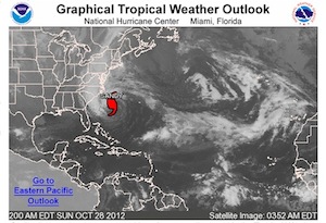
Wind gusts are expected to be reach 30 mph this morning and near 40 mph this afternoon, as Category 1 Hurricane Sandy, lurking off the coast of South Carolina, pushes northward.
National Weather Service forecasters say Sandy is likely to make landfall somewhere along the New Jersey Coast Monday night.
“The storm is expected to make a transition into a post-tropical system prior to landfall, but make no mistake, this will be a large and dangerous storm for the northeast/mid-Atlantic,” according to the forecast discussion issued by the Upton forecast center at 5 a.m. this morning.
 Sandy is expected to combine with two winter weather systems before making landfall. It is already a massive system, with tropical storm force winds stretching out up to 520 miles from its center, and hurricane force winds extending 105 miles from its center.
“The local area is expected to be affected by significant impacts from Sandy starting tonight and continuing into Tuesday,” according to forecasters.
Increasing winds and rain will be with us later this afternoon, building overnight and throughout the day tomorrow. The heaviest rain and strongest winds will arrive Monday night as the center of the storm passes closest to Long Island.
Sustained winds will reach tropical storm force (39 mph) strength, with gusts of 55 to 60 mph, Sunday night into Monday morning, as the deepening low pressure system approaches. Winds Monday afternoon into Monday night may reach 40 to 55 mph, with gusts of 70 to 80 mph.
The duration of the storm, combined with saturated grounds, high winds and partial- to full-foliage trees will likely casu widespread downing of trees and power lines, causing disruption to power and possibly transit for several days, the weather service warns. The Long Island Power Authority is warning customers to be ready for potential power outages lasting 7-10 days. See prior story.
In addition, the timing of the arrival of the storm coincident with Monday’s full moon, will bring potentially record flooding to coastal areas during Monday night’s high tide cycles, according to the forecast. See prior story.
Seas may reach 25 to 30 feet on the ocean, five to 10 feet on the Sound and five to eight feet on Peconic Bay, Monday night into Tuesday, the NWS says.
The weather service has issued a coastal flood warning, a high wind warning, a high surf advisory and a flood watch for our area.
The survival of local journalism depends on your support.
We are a small family-owned operation. You rely on us to stay informed, and we depend on you to make our work possible. Just a few dollars can help us continue to bring this important service to our community.
Support RiverheadLOCAL today.