
























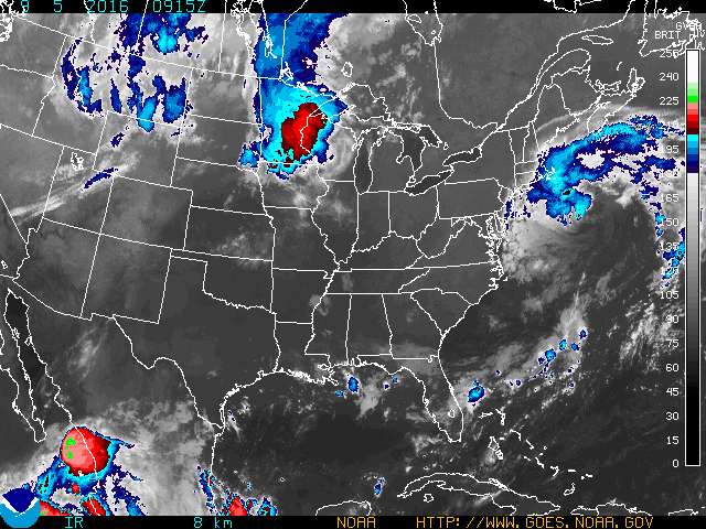
Weather forecasters have become fond of the word “meander” in their description of the movements of the post-tropical cyclone Hermine as it dances to its own tune over the Atlantic Ocean.
The latest forecast says Hermine’s center, which has slowly wandered further east than originally predicted and was located about 265 miles southeast of Montauk, will next move northwest back toward the U.S. Coast.
A tropical storm warning remains in effect for Suffolk County, where tropical storm conditions are possible today, through tomorrow afternoon, according to the current National Weather Service forecast. The warning has been dropped for Nassau County and New York City.
Storm surge is the biggest threat from the storm. Life-threatening surf, rip current conditions and significant beach erosion are likely on the Atlantic coast. All ocean beaches in New York remain closed to swimming. Riverhead town beaches will be closed today, Superintendent Ray Coyne said this morning. Personnel will be posted at all beaches until noon to make sure residents know swimming is prohibited, he said.
Today will be mostly cloudy with a “slight chance of light rain” this afternoon, with north winds 15 to 25 mph, increasing to 25 to 30 mph this afternoon and gusts up to 40 mph, according to the weather service.
And it’s more of the same for tonight and tomorrow, according to the weather agency.
“The center of Hermine will meander slowly offshore of the mid-Atlantic coast for the next couple of days,” according to the NOAA National Hurricane Center 5 a.m. update.

“Maximum sustained winds are near 70 mph with higher gusts. Hermine should remain near hurricane strength through tonight. Gradual weakening is forecast to begin by Tuesday morning,” the update says.
“Tropical-storm-force winds extend outward up to 230 miles from the center,” according to the hurricane center.
Tropical storm conditions are expected to begin over portions of the warning area — which currently extends from Suffolk County to Cape Cod — by this afternoon.
“The combination of a storm surge and the tide will cause normally dry areas near the coast to be flooded by rising waters moving inland from the shoreline. Along the immediate coastline, the surge will be accompanied by large and dangerous waves.
Heavy rainfall will remain mainly offshore through Wednesday, according to the hurricane center.
“Large waves generated by Hermine will affect the east coast from the mid-Atlantic states and expand northward along the coast of southern New England through tonight,” according to the update.
The survival of local journalism depends on your support.
We are a small family-owned operation. You rely on us to stay informed, and we depend on you to make our work possible. Just a few dollars can help us continue to bring this important service to our community.
Support RiverheadLOCAL today.
