



























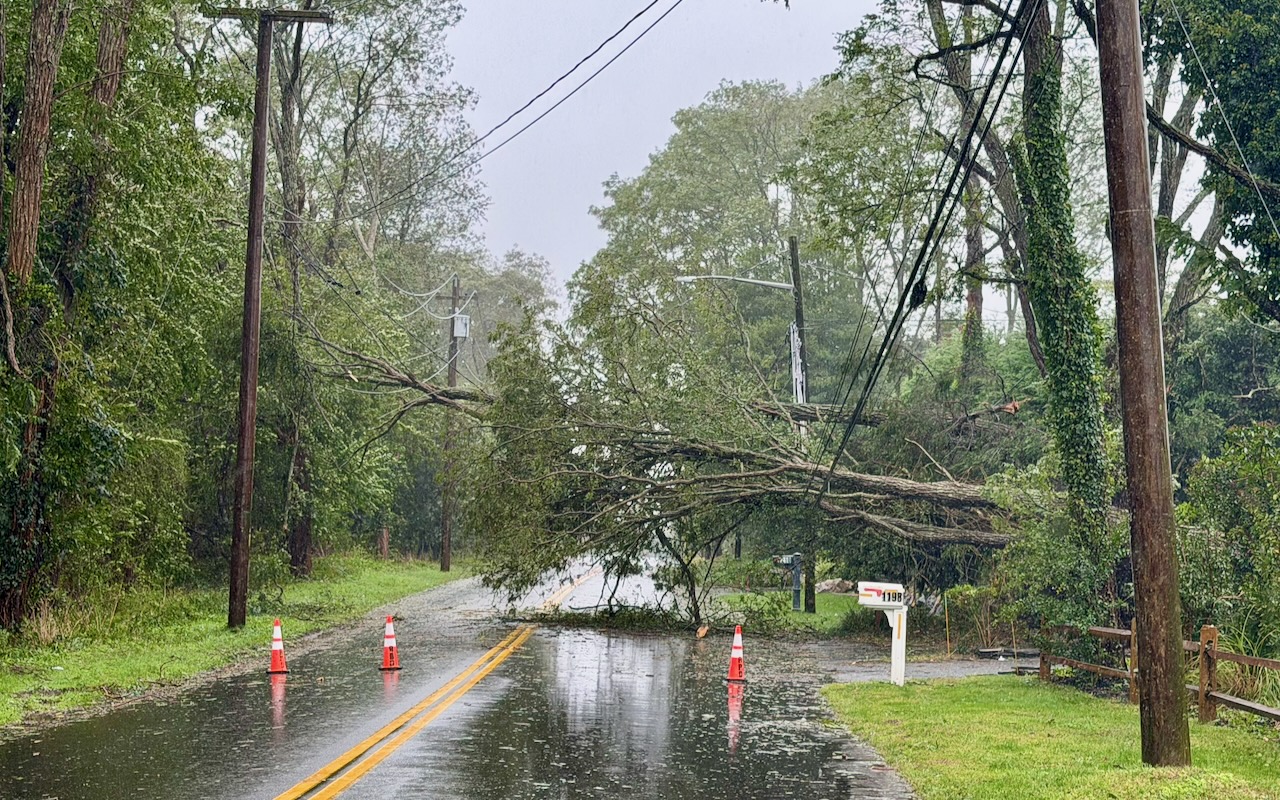
A slow-moving coastal storm continues to impact the Long Island and New York City regions this morning with steady rain and strong gusting winds, bringing down trees and power lines, causing widespread outages across the island.
A coastal flood warning remains in effect until 6 p.m. A high wind warning remains in effect until 12 noon.
More than 26,000 customers are without power across Long Island and the Rockaways as of 9:15 a.m., according to PSEG-Long Island’s outage map. The Wading River area has the highest concentration of power outages in the local area, with 205 customers without power in the neighborhood surrounding Bayberry Park, and 42 customers without power in the neighborhood west of Hulse Landing Road near Wildwood State Park. Another 78 customers are without power in Woodcliff Park in Baiting Hollow.
National Weather Service wind reports show peak wind gusts of almost 60 on the North Fork Friday night and measurements in excess of 65 mph in western Suffolk and Nassau Saturday morning.
“Trees and branches were coming down all night long,” Riverhead Highway Superintendent Mike Zaleski said this morning.
Police officers and highway department crews worked to keep roads open all night as branches and trees fell around town.
See storm photos and video: Weekend nor’easter batters local area as storm approaches Long Island (Sept. 26)
The highway department dealt with at least 25 fallen trees obstructing local roads in Riverhead over the course of the storm so far, he said. “Maybe more. It was hard to keep track of because it was happening so fast,” Zaleski said.
Middle Road between Mill Road and Osborn Avenue is currently closed due to a fallen tree across Middle Road that is resting on power lines. Police are waiting for PSEG to respond.
Coastal and low lying areas remain flooded but passable, Zaleski said.
The next high tide on the Peconic River in Riverhead is will be about noon today, with moderate flood impacts from total tides of 2.8 to 3.4 feet above mean high water levels, roughly 3 feet above normal.
The National Weather Service is forecasting showers throughout the day today, with a chance of thunderstorms this afternoon. It will remain very windy with highs in the upper 60s, the weather service said. The forecast is calling for east winds of 25 to 35 mph, with gusts up to 45 mph, diminishing to 15 to 25 mph with gusts up to 35 mph this afternoon.
The center of the coastal low pressure was south of Long Island and east of the New Jersey coast as of 4 a.m., the weather service said. The center should moving west toward New Jersey today while weakening, then stall near the New Jersey coast tonight, and drift slowly east on Monday, passing south of Long Island, weather service forecasters said. Bands of moderate to locally heavy rain and embedded thunderstorms are still possible as the low passes over the region, the weather service said.
Gale warnings are posted for Long Island Sound and East End bays until 6 p.m. East winds of 25 to 35 kt with gusts up to 45 kt are forecast for the Sound and for Peconic and Gardiners bays. Seas of 4 to 7 feet are expected in the Sound.
The survival of local journalism depends on your support.
We are a small family-owned operation. You rely on us to stay informed, and we depend on you to make our work possible. Just a few dollars can help us continue to bring this important service to our community.
Support RiverheadLOCAL today.
