

























The Riverhead Planning Board postponed action on the town’s proposed subdivision of land at the Calverton Enterprise Park after the former planning board chairperson complained that neither the map nor a report on the agenda were available to the public prior to the meeting.
“It would really be very important and helpful if the public were afforded the opportunity to review documents, to make comments and ask questions,” Barbara Blass of Jamesport told the board.
“I’m concerned that you would consider voting on this resolution or for that matter any resolution without affording the public adequate disclosure,” Blass said.
The full text of resolutions on the planning board’s agenda for action are not posted online prior to the board’s meetings.
“Please discharge your responsibility of full disclosure to the public and consider tabling the resolution,” Blass said.
The board complied with her request, tabling action on a State Environmental Quality Review analysis and findings statement for the town’s revised subdivision plan for the EPCAL site.
The town was proceeding with a 50-lot subdivision prior to signing a letter of intent with Luminati Aerospace in April 2017, which called for the town to sell Luminati most of its remaining vacant land at the site. The 50-lot subdivision application remained pending before the planning board.
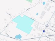
The town board subsequently approved and signed a contract of sale with Calverton Aviation and Technology — a company owned by Luminati Aerospace and a subsidiary of Triple Five. The purchaser requested the town scrap the 50-lot subdivision and instead sell the land in two large lots, so the town prepared the revised subdivision. The new plan is an eight-lot subdivision, with the bulk of the land — 1,643.8 acres — split into two lots that will be sold to Calverton Aviation and Technology. The town will retain the other lots, which include the Henry Pfeiffer Community Center site, the Grumman Memorial Park site, the site of the town’s sewage treatment plant and a parcel within the Pine Barrens core preservation area that will be preserved.
The planning board must now decide whether the revised map is consistent with its previous environmental review on the former map. Environmental planner Jeffrey Seeman prepared a consistency review analysis for the board and reviewed its contents and conclusions with the board Thursday evening. The board was set to vote Thursday on a resolution approving the report and adopting a SEQRA findings statement for the revised map.
Seeman’s consistency analysis report, which was posted on the town’s website Friday along with the revised subdivision map, recommends reinstating notations that were made on the 50-lot map which had been omitted from the eight-lot map, indicating the locations of wetlands and habitat protection areas.
The analyst also recommended that a yield map be prepared when the town’s site plan review process begins, to enable the town to assess any proposed transfer of development rights within the site.
At the board’s previous meeting, the town’s lawyer, Frank Isler, told the board the town and the purchaser had agreed in the contract of sale to allow development rights to be transferred from Lot 8 to Lot 6, because the location of the town’s bike path would prevent development of that area. Lot 8 consists of an area that was supposed to be transferred to the purchaser, Isler said. Seeman told the board the town would need to calculate the development yield of Lot 8 before any such transfer of development rights was effected. The contract of sale is silent on the question of development yield to be transferred.
Phil Barbato of Jamesport asked that the subdivision map incorporate a red-lined map released by former supervisor Sean Walter in several years ago, indicating areas he said the State Department of Environmental Conservation told town officials could not be developed due to habitat and other environmental concerns.
Barbato also told the board the subdivision is a type I action under the State Environmental Quality Review Act because state law designates the sale or lease of 100 or more acres of land by a state or municipal agency as a type I action, as well as any planning activities relating to projects located in a critical environmental area is a type I action.
When an action meets the criteria of a “type I” designation, it requires coordinated review by multiple agencies, Barbato said.
Citing Blass’ request, planning board member Richard O’Dea moved to table the resolution “to try and resolve and clear up some of the cloudiness involved in this parcel on an almost daily basis,” he said.
Member Ed Densieski seconded the motion to table.
“The speakers made some good points,” he said. “The public should have a chance to have the information we have.”
Planning board chairman Stan Carey said he was “surprised – disturbed to hear that the public did nt have the chance to review the consistency analysis or the map. I dont think that’s how we operate,” Carey said.
The resolution was tabled. The next planning board meeting takes place April 18 at 3 p.m.
A hearing on the proposed revised subdivision map has already been scheduled for the planning board’s May 2 meeting, which starts at 7 p.m.
The survival of local journalism depends on your support.
We are a small family-owned operation. You rely on us to stay informed, and we depend on you to make our work possible. Just a few dollars can help us continue to bring this important service to our community.
Support RiverheadLOCAL today.
