
























Environment
Weather service alerts public to conditions conducive to fire spread, urges caution
The National Weather Service is warning the public that conditions in the New York metro region, including Long Island, will be conducive to fire spread later today and potentially throughout the week.
Weather
Arctic blast will bring wind chill values as low as minus-10 tonight through Tuesday
An arctic front moving into the region will bring bitter cold temperatures and blustery winds, resulting in wind-chill values between 0° and -10° late tonight through early afternoon tomorrow.

Weather
Potentially heavy rain forecast Wednesday-Thursday; flash flood watch issued
It will be a soggy back-to-school for Riverhead students Thursday morning, as the remnants of Ida are expected to bring widespread rainfall of three to four inches across the area from Wednesday afternoon through Thursday morning, according to the National Weather Service.

Weather
Enhanced risk of fire spread exists again Tuesday, weather service warns
There is an enhanced potential for brush fire spread again today, the National Weather Service said in a special weather statement this morning.

News
Enhanced fire risk Monday afternoon and evening, weather service says
A combination of dry conditions, low relative humidity and strong, gusty winds make conditions ripe for the rapid spread of brush fires, the National Weather Service said in a special statement.

Weather
Potential for T-storms, heavy rain, strong winds today: National Weather Service
A rapidly moving cold front moving through the area will bring potentially severe weather to the New York metro region today.
Weather
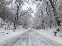
Sunday night storm could dump up to six inches of snow on Long Island: NWS
A winter storm warning has been issued for Long Island in advance of a coastal storm that’s expected to dump up to six inches of snow across the region tonight, according to the National Weather Service.

Weather
Police issue travel advisory, urging caution on snow-covered roads Friday morning
Snow is expected to continue through about 8 a.m., with accumulations of less than an inch. Highway crews are out salting roadways, which are snow-covered. Forecasters, meanwhile, are keeping a close eye on a major winter storm expected to impact the region Saturday night into Sunday, with the potential for snow, sleet, freezing rain and ice on the East End.

Weather
Heavy rain, strong winds forecast late Thursday night into Friday
The National Weather Service has issued wind and coastal flood advisories for northeast Suffolk Friday. A flood watch is also in effect.

Weather
Heat advisory in effect Tuesday and Wednesday
Heat index values are expected to climb from 95 to 104 degrees, according to the National Weather Service, which issued the advisory this morning. The advisory will remain in effect from 11 a.m. Tuesday through 9 p.m. Wednesday.
